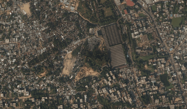
GEO Survey & Solutions is leading the surveying and mapping industry by embracing drone / aerial photography technology. Low altitude photography, combined with our high-order ground control, creates accurate, orthorectified aerial imagery and point clouds. These products enter GEO Survey’s CAD workflows to create traditional topographic maps.
Drone/Aerial technology has had a huge impact on land surveying, and it enables us to provide data that was previously only available through large scale operations. The types of jobs that is now able to be accomplished due to the increased safety for field staff cannot be understated. Through drone / aerial photography services, GEO Survey staff can now work safely on the side of high traffic roadways, creeks, river beds, and construction sites to gather survey data and imagery that would have previously put staff in high risk situations. Our rich surveying history can give you piece of mind, that the deliverables you receive have been rigorously analyzed for the quality you expect from land surveying services.